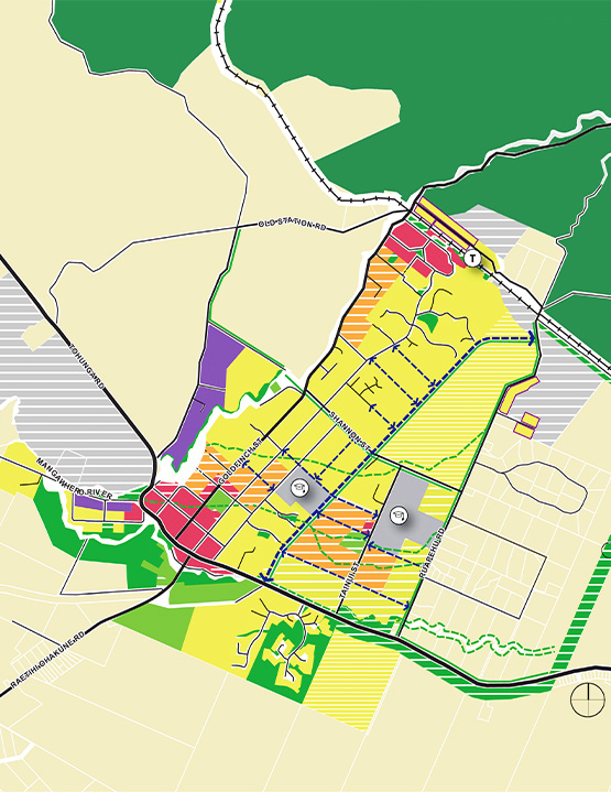
The (draft) Ohakune Spatial Plan uses this information to set out key priorities for Ohakune, looking at how the town grows and responds to the key pressures, risk and opportunities that exist. The OSP will illustrate what could go where and how aspects such as infrastructure and land uses could fit together.
The Ohakune Spatial Plan presents an optimistic but balanced approach to growth. While growth assumptions require further testing, the Spatial Plan endeavours to ensure Ohakune can continue to pursue ways to provide housing options that meet the needs of the local community. The Spatial Plan suggests Ohakune to develop around the existing centres and schools, rather than spread out on the periphery.
The (draft) Ohakune Spatial Plan made a number of recommendations, including:
- Developing and implementing land-use and zoning provisions,
- Investigating the long-term establishment of a comprehensive and connected blue-green network to address stormwater quality issues and overland flood risks,
- Seeking opportunities to incentivise and embed placemaking into projects of all sizes, which will contribute to a strong sense of place and identity for Ohakune, and
- Incorporating mana whenua as well as other heritage and environmental narratives to enhance the sense of community and belonging.
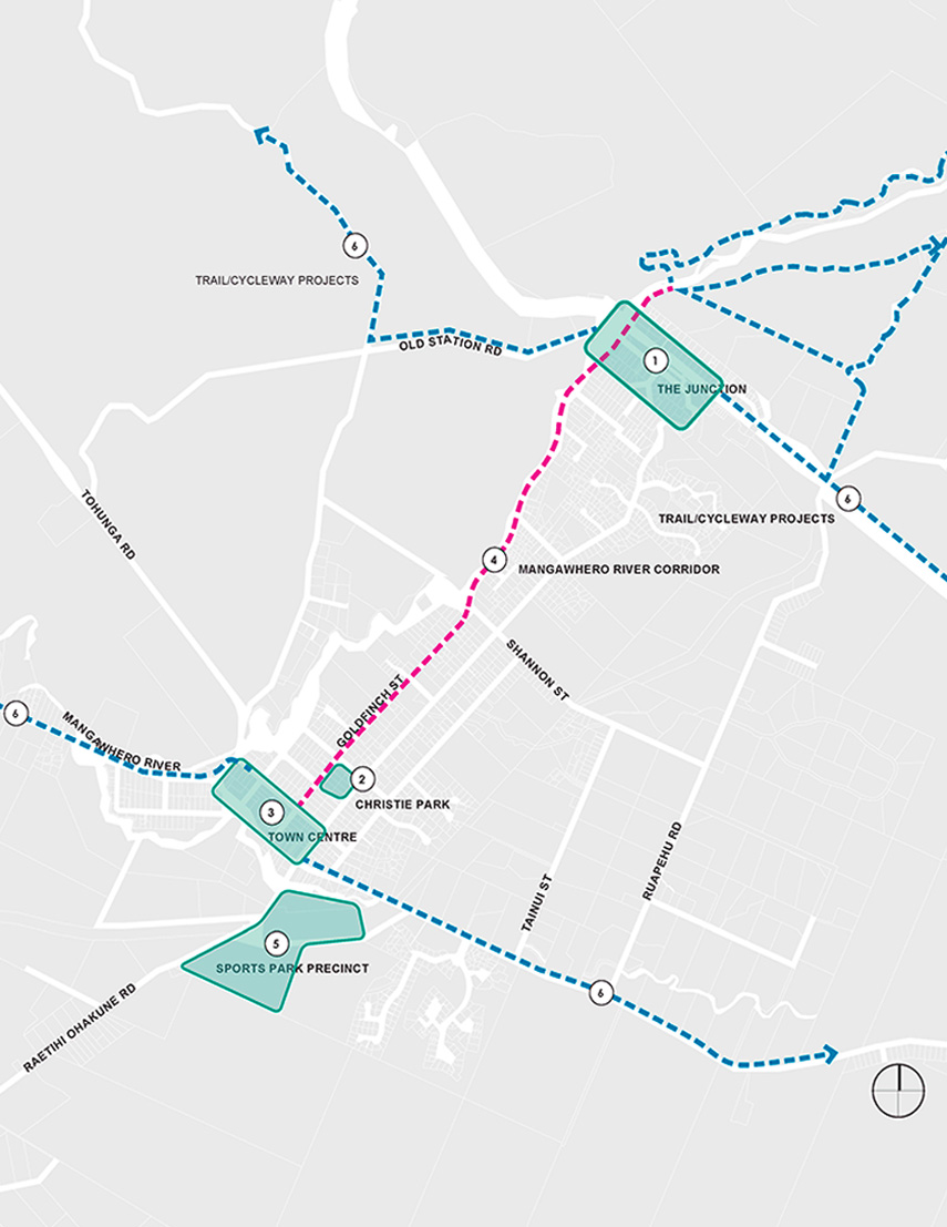
Feedback from the community and the Project Governance Group identified priority projects within the town centre and beyond. These include upgrades to Christie Park and The Junction; developing 'people-first' street designs for the town centre along with a broader and more comprehensive transport plan; and improving walking and cycling connections to reflect the outdoor tourist experience that underpins a large part of Ohakune's character and economy.
View the Ohakune Spatial Plan
Learn more about Future Ohakune
Services provided: Transport planning, landscape architecture, urban design and digital.