The Ruakura Wide Landscape Framework identifies six cultural themes drawn from the Cultural Impact Assessment:
- Celebrating whakapapa
- Recognising settlement through structures and art
- Tracing stories and people through the naming of places
- Wetlands and freshwater
- Lowland forests and terrestrial ecology
- Resources for harvest
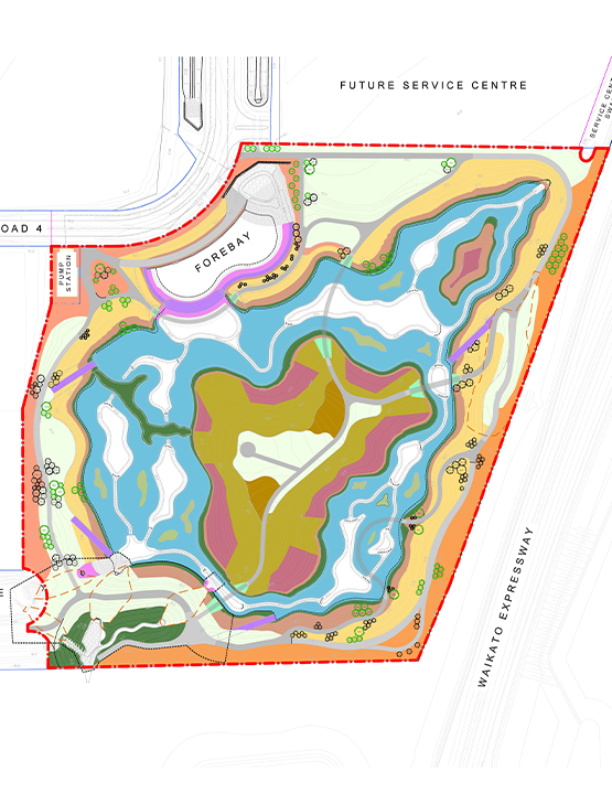
Boffa Miskell provided integrated planning, ecological, and landscape architecture services from project inception through to construction. Working closely with Tainui Group Holdings, engineers, and Council, we designed the wetland landform, low‑flow channel network, planting structure, and access routes for both maintenance and passive recreation.
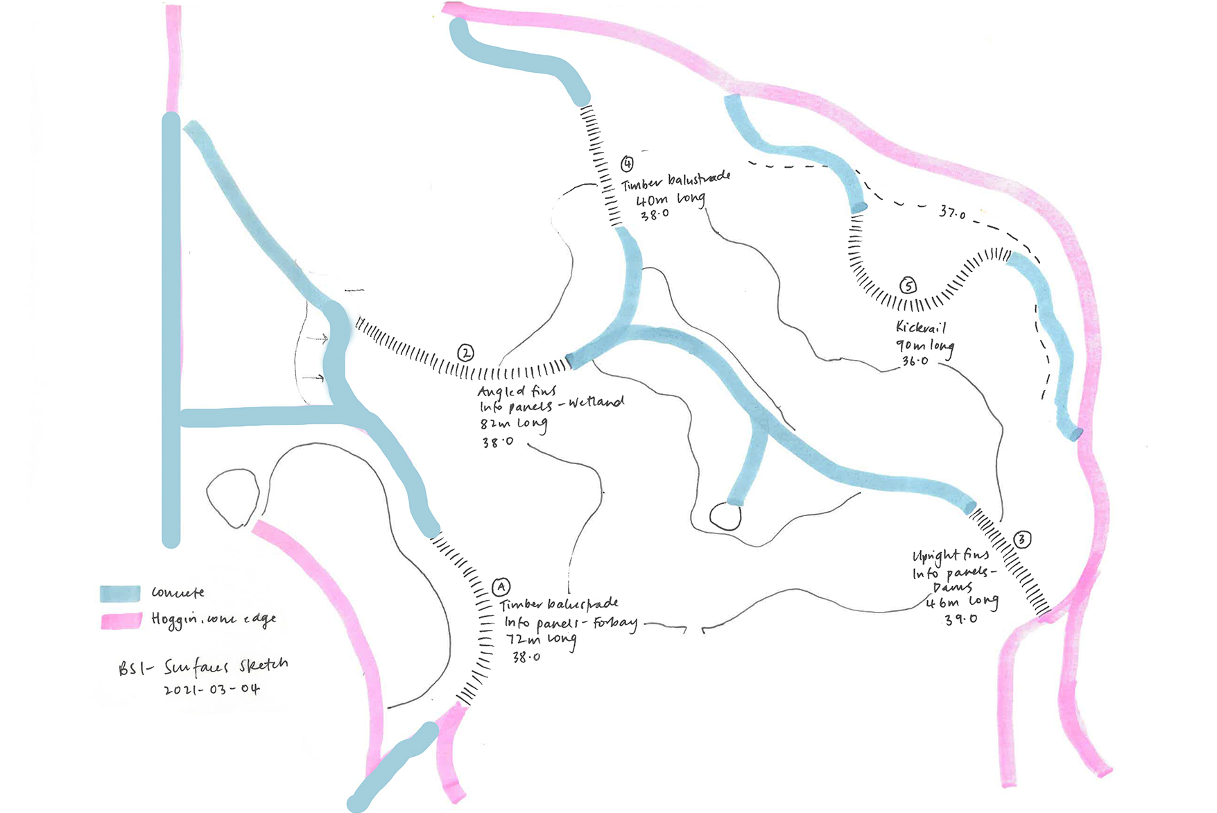
The client sought to meet statutory requirements for fish passage and low‑flow channel length while also achieving effective stormwater treatment, enhanced habitat creation, and public accessibility. Three bridges and a low‑level serpentine boardwalk were incorporated to connect a perimeter pathway and provide multiple route options through the site. The lower boardwalk allows users to experience the wetland up close, passing through stands of native planting on wetland islands, while higher perimeter paths and vantage points provide expansive views across the landscape.
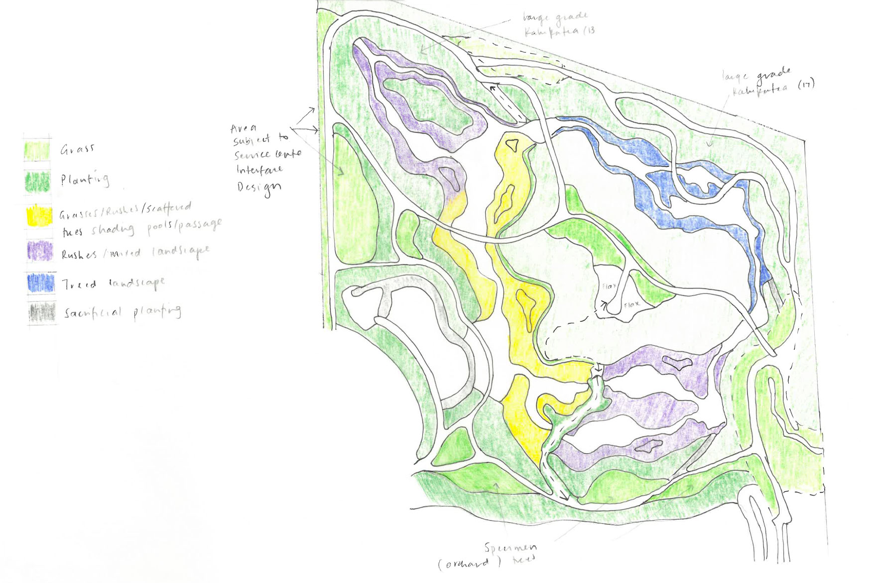
Close collaboration between landscape architects and ecologists enabled detailed consideration of eel (tuna) passage, low‑flow channel design, water depths, and habitat diversity. Over one million plants were used to establish a mosaic of lowland forest, wetland vegetation, deep pools, and meandering channels. The low‑flow channels were woven in a serpentine pattern across the wetland base, maximising channel length and integrating planted islands and varied ecological conditions.
Log piles formed from trees sourced within the wider development provide shade and shelter for aquatic invertebrates. The design accommodates seasonal and long‑term changes in water levels as surrounding development progressively comes online, managed through controlled outlets and robust planting capable of tolerating wet and dry cycles. Discreet maintenance access routes extend from the perimeter path, allowing occasional vehicle access without compromising ecological outcomes.
As planting matures, Te Wairepo Wetland is transitioning from its initial earthworked form into a functioning lowland wetland landscape. The forbay, pools, channels, and outlet work together to slow and convey stormwater before discharge into the Mangaone Stream. Timber bridges are increasingly softened by vegetation, adding visual interest and reinforcing connections across the landscape.
Over time, Te Wairepo will become a largely self‑sustaining system that manages stormwater for the Ruakura precinct while providing a high‑quality space for passive recreation, ecological enhancement, and cultural connection for the wider community.